

Blog Content
Why a Flood Insurance Elevation Certificate Matters for Maine Homeowners
A flood insurance elevation certificate is an official FEMA document that records how high your building sits relative to the Base Flood Elevation (BFE) in your area — and it directly affects what you pay for flood insurance.
Here's what you need to know at a glance:
- What it is: A standardized form (FEMA Form FF-206-FY-22-152) completed by a licensed surveyor, engineer, or architect
- What it does: Documents your property's elevation, flood zone, and building characteristics
- Who needs one: Primarily homeowners and business owners in high-risk flood zones (Zone A or Zone V) who carry an NFIP policy
- Where to get one: From your local floodplain manager, a previous owner, or a licensed land surveyor
- What it costs: Typically a few hundred dollars for a professional survey
- Why it matters: It can lower your flood insurance premium — or confirm your actual risk level
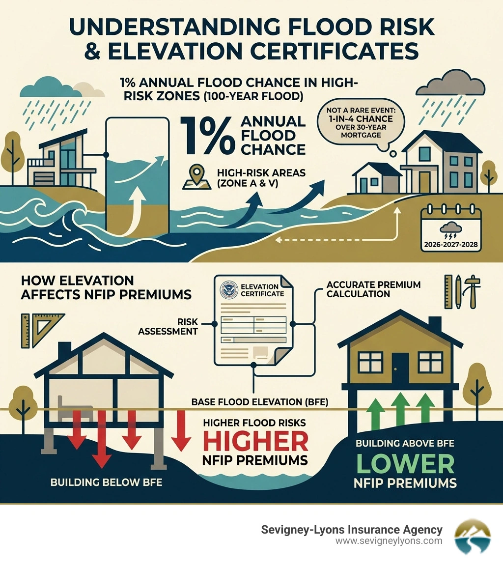
If you own property near the coast in Southern Maine — in towns like Wells, Kennebunk, Ogunquit, or Biddeford — flood risk is a real concern. High-risk flood zones carry a 1-in-4 chance of flooding over the course of a 30-year mortgage. That's not a small risk to ignore.
The National Flood Insurance Program (NFIP) covers more than 22,000 communities across the country. But getting the right premium — one that actually reflects your property's risk — often comes down to one document: the elevation certificate.
Whether you're buying a home, renewing your flood policy, or trying to reduce your costs, understanding your elevation certificate is one of the smartest moves you can make.
Flood insurance elevation certificate vocab explained:
What is a Flood Insurance Elevation Certificate?
At its core, a flood insurance elevation certificate (EC) is the "medical record" of your home's height. Just as a doctor uses your height and weight to assess your health, FEMA uses the EC to assess your home's vulnerability to rising water.
The document compares the elevation of your "Lowest Floor" to the Base Flood Elevation (BFE). The BFE is the height to which floodwater is anticipated to rise during a "base flood"—a flood that has a 1% chance of occurring in any given year. If your home is in Wells or Kennebunk and sits three feet above that BFE, you are in a much better position than a neighbor whose floor sits right at the line.
To understand how this fits into the bigger picture of property protection, it helps to know how does flood insurance work in Maine. Essentially, the higher your home sits above that "100-year" flood level, the lower your risk of a catastrophic claim.
Purpose of the EC in 2026
As of April 2026, the EC serves several critical functions for Southern Maine residents:
- Risk Assessment: It provides the data needed for FEMA’s Risk Rating 2.0 engine to calculate your specific premium.
- Floodplain Management: Local officials in Ogunquit or Biddeford use these forms to ensure new construction meets local building codes.
- Insurance Rating: While not always mandatory for every policy, it is often the best way to prove you deserve a discount.
- Compliance: It verifies that a building was constructed in accordance with the community’s floodplain ordinances.
For those who enjoy the technical details, you can review the Official FEMA Elevation Certificate Instructions to see exactly how the government defines these requirements.
Key Sections of the FEMA Form
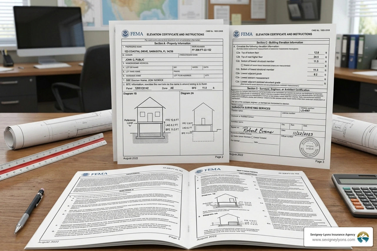
The current form (FF-206-FY-22-152) is divided into several sections that capture different "layers" of your property's profile:
- Section A (Property Information): This covers the basics—your address, building use (residential vs. commercial), and the number of flood openings (vents) in your foundation.
- Section B (FIRM Data): This references the Flood Insurance Rate Map (FIRM). It identifies your specific flood zone and the BFE for your exact location.
- Section C (Building Elevations): This is the "meat" of the form. A surveyor must physically measure the "Lowest Floor Elevation," the "Lowest Adjacent Grade" (the ground right next to your house), and the elevation of machinery like your HVAC unit.
- Section G (Community Information): This section is often completed by a local official in a town like Wells to certify that the building meets local standards.
Who Needs an Elevation Certificate in Maine?
Not every homeowner in Maine needs an EC, but for many along the coast, it's a vital piece of the puzzle. If you are looking at a Maine flood insurance near me search result, the first thing an agent will likely ask is whether you have one on file.
Requirements for a Flood Insurance Elevation Certificate in High-Risk Zones
If your property is located in a Special Flood Hazard Area (SFHA)—these are the zones on your map that start with the letters A or V—you will almost certainly interact with an EC.
- Zone A (High Risk): Common in inland areas and near rivers in Biddeford or Kennebunk.
- Zone V (High Risk - Coastal): These are coastal areas in Ogunquit or Wells subject to velocity (wave action).
- Mortgage Requirements: If you have a federally backed mortgage and live in an SFHA, your lender will require flood insurance. To get an NFIP policy for a Post-FIRM building (built after the first flood maps were created for your town), an EC is usually mandatory to set the rate.
You can learn more about how to get an elevation certificate through official channels if you find yourself in one of these high-stakes zones.
When an EC is Recommended but Not Required
What if you live in Zone X? This is considered a moderate-to-low-risk area. While an EC isn't required by the NFIP for these zones, we often recommend getting one anyway.
Why? Because even in a low-risk zone, your home might be significantly elevated. Providing a flood insurance elevation certificate to your agent can sometimes trigger "mitigation credits" that lower your premium even further. Additionally, private flood insurance carriers—which we often use to find better rates for our clients—frequently use EC data to offer more competitive pricing. For more on these options, see our Flood Insurance Maine 2025 Guide.
How an EC Impacts Your Premiums and Risk Rating
Under FEMA’s "Risk Rating 2.0" system, elevation is a primary factor in determining your cost. It’s no longer just about which "zone" you are in; it’s about your First Floor Height (FFH) relative to the water.
Note: These are illustrative estimates; actual rates depend on many factors including home value and specific location in Maine.
As you can see, every foot matters. This "Freeboard"—the distance between the BFE and your lowest floor—is the single best way to save money. If you are looking for a flood insurance coverage agency NH Maine, we can help you analyze your EC to see if your rate accurately reflects this height.
Using a Flood Insurance Elevation Certificate to Lower Costs
The EC doesn't just record height; it records mitigation. If you have a crawlspace or an enclosure below the BFE, the EC documents whether you have proper flood vents. These vents allow water to flow through the foundation rather than pushing against it, which significantly reduces the risk of structural collapse.
The EC also notes where your machinery is. If you move your furnace or AC compressor from the basement to the first floor (or onto a platform), and a surveyor updates your flood insurance elevation certificate, your premiums could drop substantially. Local resources like the Maine Community Assistance - Flood Insurance page provide excellent guidance on these local mitigation standards.
The Role of the Community Rating System (CRS)
Many towns in Southern Maine, like Wells and Kennebunk, participate in the Community Rating System (CRS). This is a voluntary program where the town goes above and beyond FEMA's minimum requirements. In exchange, every resident in that town gets a discount on their flood insurance—sometimes as much as 10% to 25%.
Part of a town’s CRS score depends on how well they maintain their EC records. Your local floodplain manager is a hero in this story; they keep these documents on file to ensure the whole community stays safer and pays less.
How to Obtain or Find an Existing Elevation Certificate
Before you spend money on a new survey, do a little detective work. There is a good chance an EC already exists for your property.
Where to Look First:
- Local Floodplain Manager: Contact the town office in Wells, Kennebunk, or Biddeford. They often keep copies of ECs for any building constructed or substantially improved in the last few decades.
- The Seller or Previous Owner: If you are buying a home, ask the seller. They may have one from when they purchased the property or from a recent remodeling project.
- The Property Deed: Occasionally, elevation data or the certificate itself is attached to the deed or closing documents.
- The Developer: For newer subdivisions, the original builder likely had to file an EC to get their permits.
If these leads turn up empty, you can submit an Elevation Certificate Request - Maine Coast Surveying or contact another local professional.
Hiring a Professional in Southern Maine
If you must get a new one, you need a licensed professional land surveyor, engineer, or architect. In Maine, only these licensed individuals can legally certify the elevation data in Section C.
Cost Factors:
- Complexity: A simple slab-on-grade home is cheaper to survey than a complex coastal home with multiple levels and a crawlspace.
- Location: If the surveyor has to travel far or if the property is difficult to access, the price goes up.
- Availability: During the busy real estate season in Ogunquit or Kennebunk, you might pay a premium for a quick turnaround.
Expect to pay anywhere from $500 to $1,500 for a professional EC in Southern Maine. While that feels like a lot, if it saves you $1,000 a year on insurance, it pays for itself in just twelve months.
Step-by-Step Process to Get a New EC
- Site Visit: The surveyor will come to your property to take physical measurements.
- Equipment Setup: They use high-precision GPS and leveling equipment to determine exactly how high your floors and the surrounding ground sit.
- Datum Conversion: This is the "math" part. They must ensure their measurements match the "datum" used on the FEMA maps (usually switching between NGVD 29 and NAVD 88).
- Photographs: A valid EC must include clear, color photos of the front and back of the building, showing the foundation and any flood vents.
Frequently Asked Questions about Elevation Certificates
Can an EC help remove my property from a flood zone?
Yes! This is one of the most powerful uses of a flood insurance elevation certificate. If the EC proves that the "Lowest Adjacent Grade" (the lowest point of the ground touching your house) is actually higher than the BFE, you can apply for a Letter of Map Amendment (LOMA).
If FEMA approves your LOMA, your property is officially removed from the high-risk zone. This can eliminate the federal requirement to carry flood insurance and significantly increase your property value.
Do I need a new EC after remodeling my home?
Generally, yes, if the remodel was a "substantial improvement" (costing more than 50% of the home's value) or if you changed the footprint. If you converted a garage into a living space or added an enclosure, your "Lowest Floor" may have changed, which invalidates your old EC.
Also, if FEMA updates the flood maps for Wells or Biddeford, your old EC might still be valid for the physical measurements, but your insurance agent will need to "re-map" it to the new BFE.
What is the difference between pre-construction and post-construction ECs?
- Pre-Construction: These are based on architectural drawings and are used to get a building permit. They show where the house is intended to be built.
- Post-Construction: This is the final version. Once the house is finished, the surveyor returns to verify that the home was actually built at the height promised in the plans. For insurance purposes, you always want the "Finished Construction" certificate.
Conclusion
Navigating flood insurance can feel like trying to swim against a riptide. But at Sevigney-Lyons Insurance Agency, we believe that knowledge is your best life jacket. A flood insurance elevation certificate is more than just a piece of government paperwork; it is a tool that helps you understand your risk and potentially save thousands of dollars over the life of your home.
Whether you are in Wells, Kennebunk, Ogunquit, or Biddeford, our team of independent agents is here to help you make sense of your flood zone and your premium. We have deep roots in the Southern Maine community and access to over 20 top carriers to find the coverage that fits your family perfectly.
Don't wait for the next storm to wonder if you're covered.
Get a Free Maine Flood Insurance Quote today and let us help you secure your piece of the Maine coast.


